Showing 1–32 of 76 results
-
-
-
-
-
-
Cartography Navionics Platinum+ ITALIA LAGHI COSTE
Display real-time position direction speed and track. Bathymetrics navigation aids with Xplain � technology port services (gas stations mooring shipyards etc. With phone numbers where available) tides and currents.Verify that the instrument is capable of reading MSD-SD memory media greater than 2 GB in capacity.
-
Cartography Navionics Platinum+ MAR ADRIATICO MAR IONIO
Display real-time position direction speed and track. Bathymetrics navigation aids with Xplain � technology port services (gas stations mooring shipyards etc. With phone numbers where available) tides and currents.Verify that the instrument is capable of reading MSD-SD memory media greater than 2 GB in capacity.
-
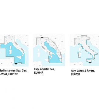
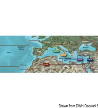
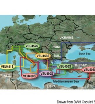
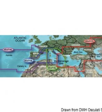
Cartography Navionics Platinum+ MAR MEDITERRANEO E MAR NERO
Display real-time position direction speed and track. Bathymetrics navigation aids with Xplain � technology port services (gas stations mooring shipyards etc. With phone numbers where available) tides and currents.Verify that the instrument is capable of reading MSD-SD memory media greater than 2 GB in capacity.
-
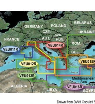
Cartography Navionics Platinum+ MAR TIRRENO E MEDITERRANEO CENTRALE
Display real-time position direction speed and track. Bathymetrics navigation aids with Xplain � technology port services (gas stations mooring shipyards etc. With phone numbers where available) tides and currents.Verify that the instrument is capable of reading MSD-SD memory media greater than 2 GB in capacity.
-

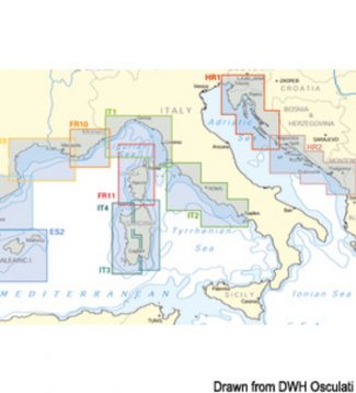
Cartography Navionics+ ITALIA LAGHI COSTE
Essential details including the port plans bathymetry list of phone numbers and much more. Hundreds of thousands of changes by theNavionics Community viewable on some GPS plotter compatible with Freshest Data. Access to any cartographic layers in the region purchasedSonarChart � the bathymetric map HD Navionics that reflects the ever-changing bottom conditions. Auto-routing SD /…
-
Cartography Navionics+ MAR ADRIATICO MAR IONIO
Essential details including the port plans bathymetry list of phone numbers and much more. Hundreds of thousands of changes by theNavionics Community viewable on some GPS plotter compatible with Freshest Data. Access to any cartographic layers in the region purchasedSonarChart � the bathymetric map HD Navionics that reflects the ever-changing bottom conditions. Auto-routing SD /…
-
Cartography Navionics+ MAR TIRRENO E MEDITERRANEO CENTRALE
Essential details including the port plans bathymetry list of phone numbers and much more. Hundreds of thousands of changes by theNavionics Community viewable on some GPS plotter compatible with Freshest Data. Access to any cartographic layers in the region purchasedSonarChart � the bathymetric map HD Navionics that reflects the ever-changing bottom conditions. Auto-routing SD /…
-
Garmin Bluechart G3 Charts Garmin Bluechart G3 micro SD regular
165,00 €Garmin is committed to provide extremely detailed cartography products and to ensure comprehensive coverage. The new marine chart BlueChart G3 offers state-of-the-art coverage, clear and detailed information integrated with data from Garmin and Navionics® charts. The new BlueChart also includes the Auto Guidance feature used to allow the chartplotter to automatically create a route to…
-
Garmin Bluechart G3 Charts Garmin Bluechart G3 Vision HD micro SD card small
220,00 €Garmin is committed to provide extremely detailed cartography products and to ensure comprehensive coverage. The new marine chart BlueChart G3 offers state-of-the-art coverage, clear and detailed information integrated with data from Garmin and Navionics® charts. The new BlueChart also includes the Auto Guidance feature used to allow the chartplotter to automatically create a route to…
-
Garmin Bluechart G3 Charts Garmin Bluechart G3 Vision micro SD card large
430,00 €Garmin is committed to provide extremely detailed cartography products and to ensure comprehensive coverage. The new marine chart BlueChart G3 offers state-of-the-art coverage, clear and detailed information integrated with data from Garmin and Navionics® charts. The new BlueChart also includes the Auto Guidance feature used to allow the chartplotter to automatically create a route to…
-
Garmin Bluechart G3 Charts Garmin Bluechart G3 Vision micro SD card regula
305,00 €Garmin is committed to provide extremely detailed cartography products and to ensure comprehensive coverage. The new marine chart BlueChart G3 offers state-of-the-art coverage, clear and detailed information integrated with data from Garmin and Navionics® charts. The new BlueChart also includes the Auto Guidance feature used to allow the chartplotter to automatically create a route to…
-
Garmin Box For Handheld Gps BOX FOR HANDHELD GPS
Protective carring case for all models Etrex Gpsmap
-

Garmin Gps 73 GPS 73
The perfect navigational solution for boats sailboats or small watercraft that do not havea chartplotter. It�s also ideal as an importantemergency navigation backup for all vessels.Its high-sensitivity GPS marks and stores 1 000waypoints and 100 tracks so you can navigate ri-ght back to them. Use on land or water floating.Features SailAssist including virtual starting line…
-
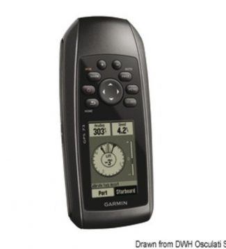
Garmin Gps 73 Portable Gps GARMIN GPS 73 portable GPS
185,00 €GARMIN GPS 73 is heavy-duty, watertight and floating. 12-channel receiver with 1-Hz GPS antenna for higher precision. 2.6-inch high-contrast single-colour display, 100 tracks that you can navigate back to, specific navigation backup. GPS 73 is NMEA 0183 compatible. To transfer data to your device, it easily connects to your computer via USB and you can…
-
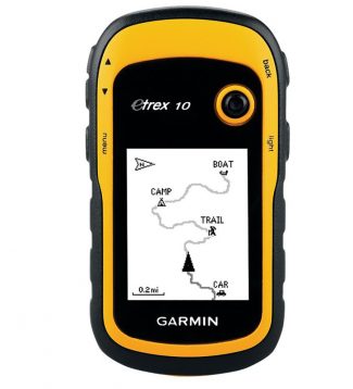
Garmin Gps Etrex 10 PORTABLE GPS
GPS High Sensitivity WAAS enabled – Display monochromatic LCD 2 2� 128 x 160 pixel – Connect to PC via USB – Joystick multifunction – World basemap preloaded – Waterproof IPX7 – Autonomy 25 hours 2 AA battery NiMH or Lithium recommended (not included) – Dim. mm. 103x54x33 weight gr. 142 Strap USB cable instruction…
-
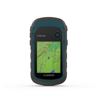
Garmin Gps Etrex 22x GPS ETREX 22X
2.2 �anti-glare color screen with a resolution of 240 x 320 pixels with 65k colors for better readabilityFunction management joystick Preloaded with TopoActive Europe maps which include roads and paths for cycling and walkingThe support of GPS and GLONASS satellite systems allows detection in the most remote places and stillmore reliable than just using GPS8…
-
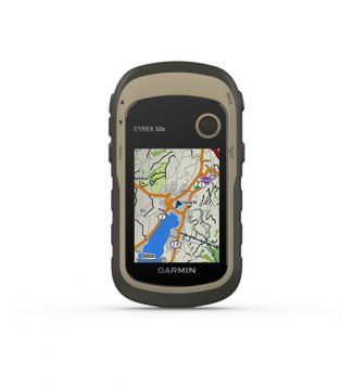
Garmin Gps Etrex 32x GPS ETREX 32X
2.2 anti-glare color screen with a resolution of 240 x 320 pixels with 65k colors for better readabilityFunction management joystick.Preloaded with TopoActive Europe maps which include roads and paths that can be traveled by bike and on footThe use of GPS and GLONASS satellite systems allows emoti detection in a more reliable way than theonly…
-
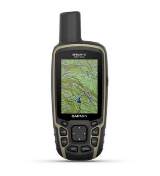
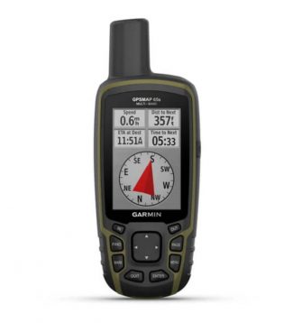
Garmin Gps Map 65 GPS MAP 65
Rugged waterproof 65k color touchscreen with push buttons. 2.6 �anti-glare screen160 x 240 pixels .. High sensitivity receiver Quad Helix antenna Multi-band support (GPS GLONASS and Galileo QZSS IRNSS). 16 GB of onboard memory and a microSD � card slot for expandable storage anddownload much more information in a practical way. Battery life: up to…
-
Garmin Gps Map 65s GPS MAP 65S
Rugged waterproof 65k color touchscreen with push buttons and 2.6 �anti-glare screen.ABC sensors. High sensitivity receiver Quad Helix antenna Multi-band support (GPS GLONASS and Galileo QZSS IRNSS). 3-axis compass with barometric altimeter. 16 GB of onboard memory and a card slotmicroSD � for expandable storage and conveniently download much more information. Connectivitywireless via Bluetooth� and…
-
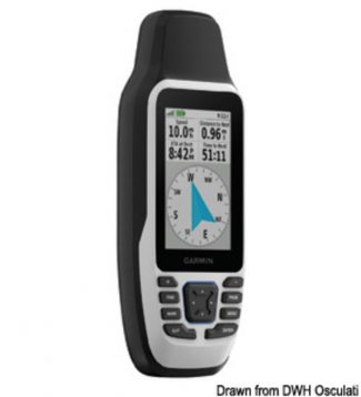
Garmin Gpsmap 79s Handheld Gps GARMIN GPSMAP 79s handheld GPS
Stay on course with the GPSMAP® 79s. This floating handheld GPS has a high-resolution colour display that can be read in the sun. The glass is even scratch-resistant and fogproof. With support for multiple satellite constellations, it gets accurate, reliable tracking and positioning around the world. Get the world’s basemap or the optional BlueChart® g3…
-

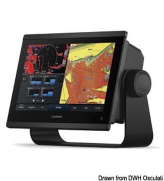
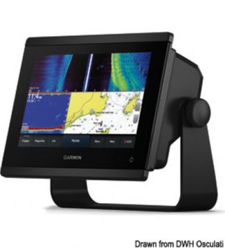
Garmin Gpsmap Plus 722 (xs) And 922 (xs) GARMIN chartplotter GPSMAP 723
1.069,00 €The new GPSMAP 723 and 923 chartplotters with sunlight-readable and highly backlit screen offer bright colours and crisp details for top light quality in any conditions. With their added processing power and new slimline design, it’s easy to retrofit these plotters in a wide range of dash configurations. Also available in the xsv version with…
-

Garmin Gpsmap Plus 722 (xs) And 922 (xs) GARMIN chartplotter GPSMAP 723 xsv
1.279,00 €The new GPSMAP 723 and 923 chartplotters with sunlight-readable and highly backlit screen offer bright colours and crisp details for top light quality in any conditions. With their added processing power and new slimline design, it’s easy to retrofit these plotters in a wide range of dash configurations. Also available in the xsv version with…
-
Garmin Gpsmap Plus 722 (xs) And 922 (xs) GARMIN chartplotter GPSMAP 923
1.599,00 €The new GPSMAP 723 and 923 chartplotters with sunlight-readable and highly backlit screen offer bright colours and crisp details for top light quality in any conditions. With their added processing power and new slimline design, it’s easy to retrofit these plotters in a wide range of dash configurations. Also available in the xsv version with…
-
Garmin Gpsmap Plus 722 (xs) And 922 (xs) GARMIN chartplotter GPSMAP 923 xsv
1.809,00 €The new GPSMAP 723 and 923 chartplotters with sunlight-readable and highly backlit screen offer bright colours and crisp details for top light quality in any conditions. With their added processing power and new slimline design, it’s easy to retrofit these plotters in a wide range of dash configurations. Also available in the xsv version with…
-
Garmin Gpsmap Plus 722 (xs) And 922 (xs) GARMIN GPSMAP 723 xsv + Radar GMR18 HD+
2.874,00 €The new GPSMAP 723 and 923 chartplotters with sunlight-readable and highly backlit screen offer bright colours and crisp details for top light quality in any conditions. With their added processing power and new slimline design, it’s easy to retrofit these plotters in a wide range of dash configurations. Also available in the xsv version with…
-
Garmin Gpsmap Plus 722 (xs) And 922 (xs) GARMIN GPSMAP 923 xsv + Radar GMR18 HD+
3.299,00 €The new GPSMAP 723 and 923 chartplotters with sunlight-readable and highly backlit screen offer bright colours and crisp details for top light quality in any conditions. With their added processing power and new slimline design, it’s easy to retrofit these plotters in a wide range of dash configurations. Also available in the xsv version with…
-

 Glomex 5-cm Deck Fairlead In Golden Colour 5-cm deck fairlead in golden colour
  Viadana Delrin Ball Bearing Block Ball-bearing block 1pulley swivel w/becket 12x57mm
  Viadana Delrin Ball Bearing Block Ball-bearing block 1pulley w/swivel head 8x28
  Viadana Delrin Ball Bearing Block Ball-bearing block 1pulley swivel w/becket 8x28mm
  Viadana Delrin Ball Bearing Block Ball-bearing block 1pulley fixed/swivel U 6x22mm
 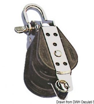 Viadana Delrin Ball Bearing Block Ball-bearing block 2pulley shackle becket 10x38mm
  Viadana Delrin Ball Bearing Block Ball-bearing block 1pulley swivel w/becket 10x38mm
 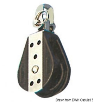 Viadana Delrin Ball Bearing Block Ball-bearing block 1pulley fixed/swivel 14x76mm
 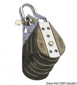 Viadana Delrin Ball Bearing Block Ball-bearing block 3pulley shackle 10x38mm
 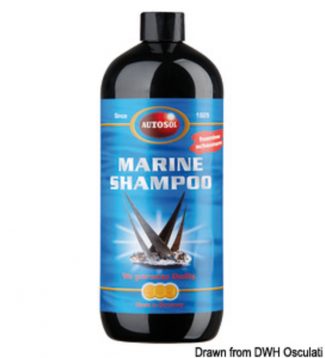 Autosol Low Foam Boat Shampoo AUTOSOL low foam boat shampoo
 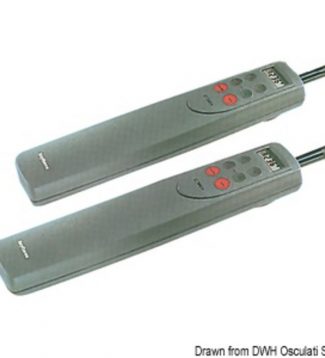 Autopilots Raymarine Raymarine ST1000Plus autopilot
 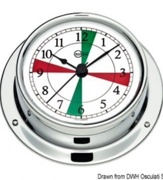 Barigo Instruments Tempo S Barigo Tempo S chromed clock w/radio sectors
 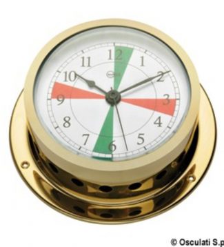 Barigo Instruments: Star Barigo Star quartz clock w/ radiosectors golden br
 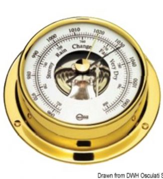 Barigo Instruments Tempo S Barigo Tempo S polished barometer
 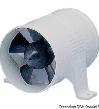 Attwood Turbo Axial Electric Blower Attwood Turbo blower 6 m³ 12 V
 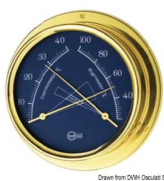 Barigo Instruments: Regatta Barigo Regatta blue hygro-thermometer
 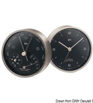 Barigo Instrument: Pentable Barigo Pentable black baro/thermo/hygrometer
 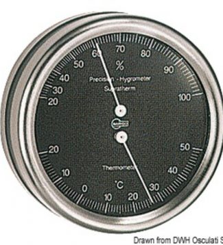 Barigo Instruments: Orion Barigo Orion thermo/hygrometer black dial
 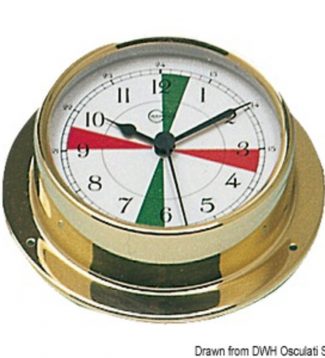 Barigo Instruments Tempo M Barigo Tempo M clock w/radio sectors
 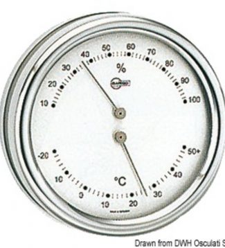 Barigo Instruments: Orion Barigo Orion thermo/hygrometer silver dial
 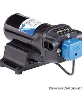 Autoclave Jabsco Dimond V-flo 5 Jabsco V-FLO 5 fresh water pump 12 V 19 l 2.75 bar